GeoWerkstatt-Project of the Month August 2022
Project: Visual route communication via geometric deformation
Researcher: Olga Shkedova, Stefan Fuest
Project idea: Generate the most efficient route according to user preferences and develop visual communication for the preferred route choice using geometric deformation.
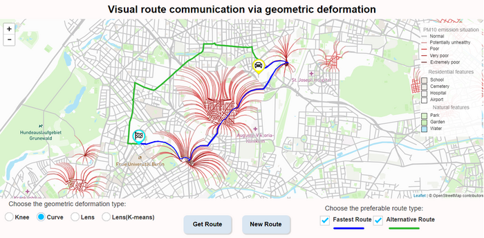
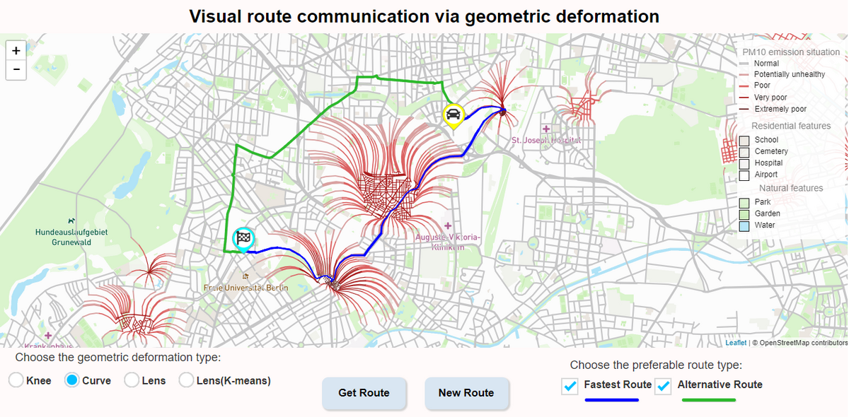
With gadgets dissemination in the last decade, map navigation became highly demanded in everyday peoples’ life. There are numerous reasons and conditions for route map usage, which depend on personal purposes. Hence, each route built by cartography application should take into consideration individual requirements. However, the majority of nowadays routing services provide the most efficient route concerning the travel time only and do not account for other possible relevant aspects. For route to be more user-oriented and proper under different circumstances, visual communication via geometric deformation was proposed. The function of the stated communication is to promote the prioritized path by presenting it on the map in an intuitive, geometrically, and visually attractive manner.
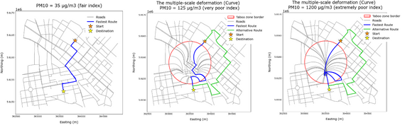
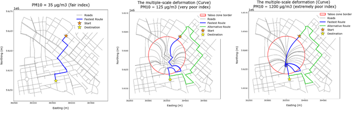
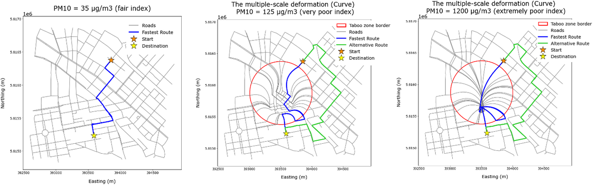
For our research, we assumed regions of high Particulate matter (PM10) contamination as Taboo zones that desired to be avoided by map users due to the health hazardous impact. In addition, human perception characteristics, psychological factors, and visual variables were investigated to communicate accordingly the existence of those potentially dangerous zones. Thus, a 3D illusion of a hollow or a pit on a 2D map was determined for polluted areas representation. Such a method of visualization was expected to motivate map-readers always choose the route that navigates around hazardous territories instead of the one that crosses them, even despite time consumption. For the illusion effect, two types of geometric distortions were applied. The first is based on multiple-scale transformation, and the second is founded on a concave lens alteration. The degree of deformation and consequently the depth of the illusionary pit on the way were performed proportionally to the PM10 index.
Further, an automated system for two scenarios of route generation was created. One route was calculated according to commonly used the fastest path algorithm, and the other considering supposed environmental requirements. As long as the fastest path accounted for travel time only, it was geometrically distorted while crossing the polluted zone–pit, in opposition to the alternative route, which was yielded around the dangerous areas and constantly preserved the original shape of the roads.
 ©
ikg
©
ikg
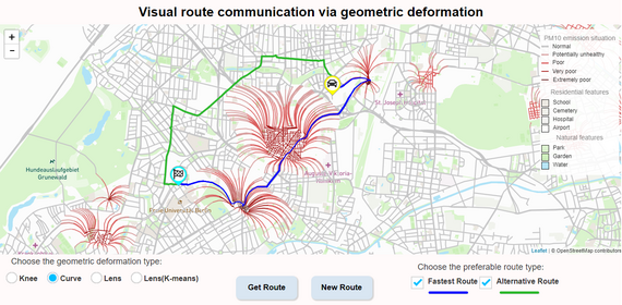
Afterward, the developed visual communication was evaluated within a user study. The participants were asked to choose a preferred route between the fastest and the alternative under the different PM10 indices influence inside Taboo zones. Additionally, visual variables such as color, thickness, and shadowed figures were tested for a hollow or pit perception improvement. The survey responses demonstrated that, on average, more than 75% of users tended to advantage the alternative path after the fastest was deformed by multiple-scale transformation and more than 50% after the concave lens distortion. The tendency was stronger with pollution level increases and visual variables additions. Based on the obtained results, a web map application was implemented. It promotes the most efficient route considering the travel time and the PM10 emission situation during navigation.
 ©
ikg
©
ikg


