GeoWerkstatt-Projekt des Monats Februar 2022
Projekt: Nation-wide flood mapping using satellite SAR observations of Sentinel-1 and Google Earth Engine
Forschende: Dr.-Ing. Mahmud Hagshenas Haghighi
Projektidee: Radar satellite images are an extremely useful tool to assess flooding and flood risks of the Earth surface and is thus very suitable to help people in danger.
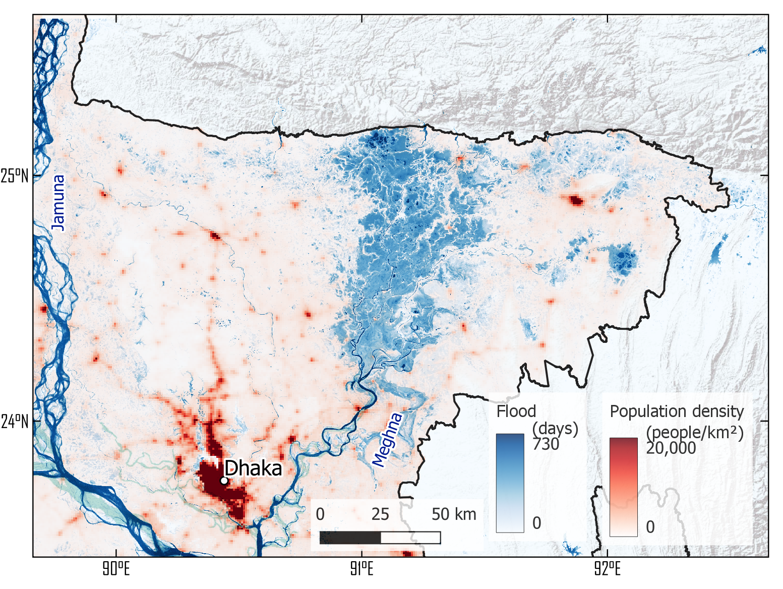
Monsoon rains in Bangladesh and other countries across South Asia bring floods that damage roads and vital infrastructure and leave thousands stranded and without food, power, and electricity. Remote sensing, particularly after the launch of the Sentinel mission, provides a unique asset to assess the flood impact in situations like these and to support vulnerable people during the event. Repeated satellite observations from SAR missions that penetrate through clouds can identify floods at large scales and delineate their extents. Performing such analysis for floods in the past years can provide further insight about areas that are more prone to flood risk.
However, regular monitoring of floods at large scales can face two challenges: The first challenge is a large amount of data that needs to be transferred and analyzed. The second challenge is the inconsistencies in the data over large areas. In particular, significant incidence angle variations from the near range to the far range of SAR images can significantly alter the backscattering and make it difficult to create a uniform mosaic to delineate flood areas across large areas.
 ©
IPI
©
IPI
In our study, we address both challenges: The Google Earth Engine cloud-based platform that hosts Sentinel-1 archive allows us to access and analyze a large amount of data on the same platform. The second challenge is addressed by a normalization based on incidence angle. The normalization of backscattering values allows us to create uniform bi-weekly mosaics of SAR images. By adaptive thresholding of the mosaic images, we then assess how the floods have developed. Afterwards, we are able to calculate a flood frequency map using the estimated flood history. Finally, in combination with population density, land cover, and infrastructure data, the flood map is ready to be used to estimate the risk of flood.


