GeoWerkstatt-Projekt des Monats September 2023
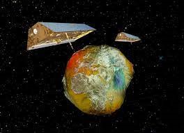
Projekt: Terrain water storage study based on the new harmonic parameterization technique and line of sight gravity data between GRACE satellites
Forschende: Dr. Mohsen Feizi, Prof. Dr.-Ing. Jakob Flury
Projektidee: This study focuses on the calculation of the variation in terrestrial water storage (TWS) at monthly time scales over Iran utilizing gravity data provided by GRACE-FO missions and based on a regional harmonic basis function. We will apply regional harmonic basis functions. i.e., spherical cap harmonic (SCH) functions to provide nearly full extraction of gravitational signal over a spherical cap region that are generally underestimated by the GRACE Level 2 product.
Line of sight gravity differences
The GRACE-FO laser system can measure the magnitude of the gravity difference between two satellites (A and B) projected along the line of sight (LOS). Using this technique, we will compute line-of-sight gravity data (LGD), which is fully sensitive to mass variations over the earth.
 ©
ife
©
ife
Linear models of geopotential modeling using LGD and based on SCHA
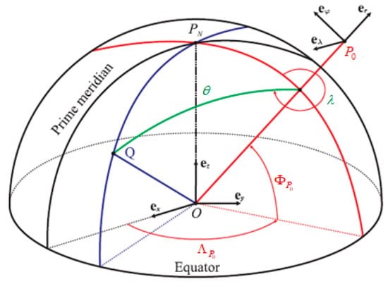
Then, the solution of a Laplace equation for the boundary values over a spherical cap is used to expand the geo-potential coefficients in terms of Legendre functions with a real degree and integer order suitable for regional time variable modelling, which is used to constrain the geo-potential coefficients using LGD measurements. The gravity vector based on the spherical cap coordinate system is defined by the following Figure (Fig.2):
 ©
ife
©
ife
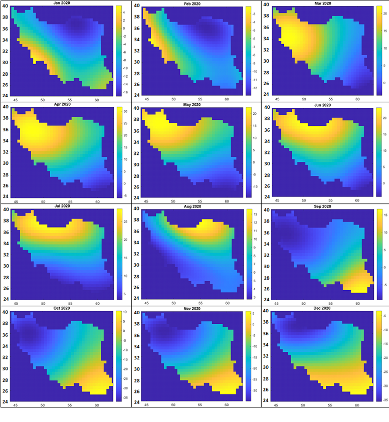
Modeling of terrestrial water storage (TWS) in Iran using Line Of Sight Gravity Difference (LGD) data , MASCON technique and based on the local harmonic basis functions.
We present our on-going study of regional gravity field and surface mass change recovery with an example of Iran. We use new parameterization based on spherical cap harmonic (SCH) functions that is suitable for modelling gravitational potential over a spherical cap region. There are a few advantages of efficiency and flexibility in this approach:
- The nearly identical potential field based on spherical harmonic (SH) functions can be expressed with a substantially less number of parameters in terms of SCH functions.
- The region-specific constraints can be implemented.
- Temporal resolution of the gravity recovery can be flexible and adjusted depending of the satellite coverage.
We use the instantaneous gravitational data along the satellite orbit such as Line-of-sight Gravity Difference (LGD) time series that are computed directly from the laser ranging interferometer (LRI) measurements of range change between two satellites. Using defined new geodetic technique and obtained time variable geopotential Harmonic coefficients we calculate mass changes related to Terrain water storage over Iran. In fact, mass variations are expressed on regular geometric shapes as a uniform layer (which represents the equivalent water level). For validation of the result, we compared TWS data obtained from local time variable coefficients with the available 10 well data from the case study. The correlation result shows the ability of the GRACE-FO mission in environmental studies in hot-dry climates.
 ©
ife
©
ife


