Graduates 2024

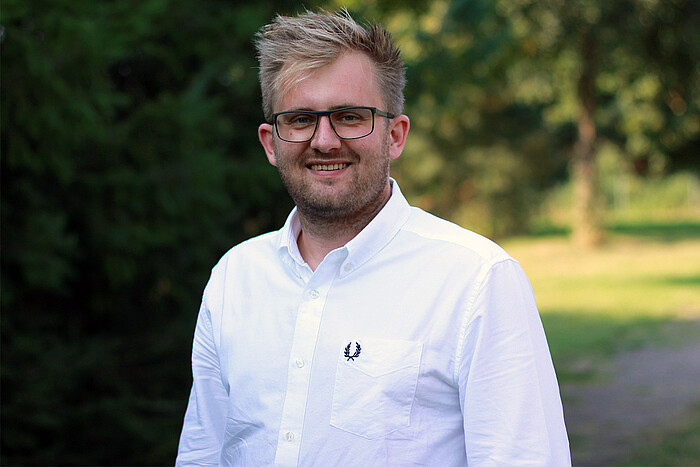

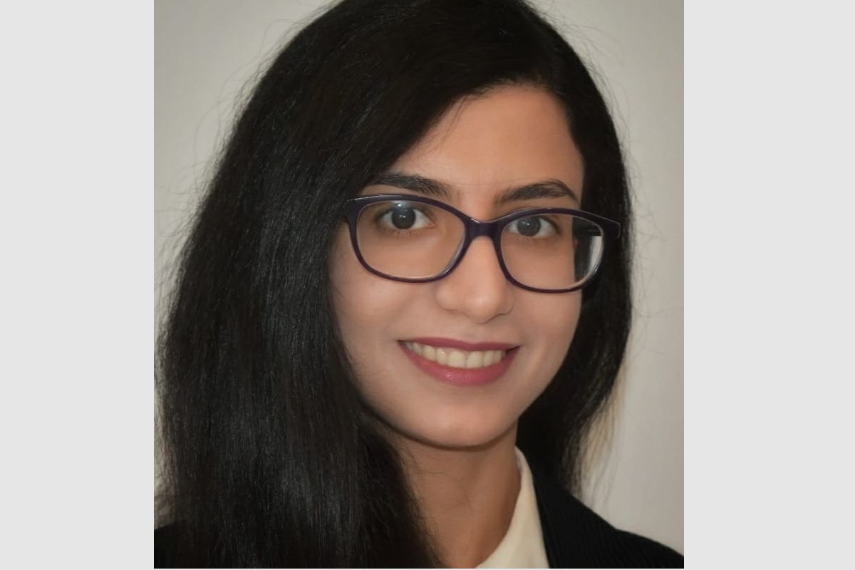
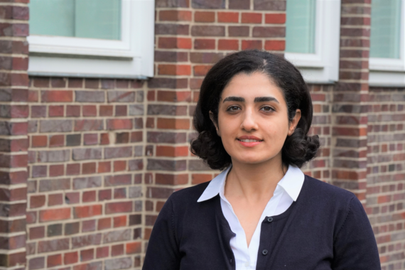
Christian Grannemann, M. Sc.
from Germany
Employer: Leibniz University Hannover, Institute of Photogrammetry and GeoInformation
"I never expected that I’d end up switching from a Bachelor’s in Electrical Engineering and Information Technology to Geodesy."
-
read more about Christian's experience
I never expected that I’d end up switching from a Bachelor’s in Electrical Engineering and Information Technology to Geodesy. But when it came time to choose my Master’s program, the Navigation and Field Robotics track instantly caught my attention—especially with its practical applications in self-driving cars and navigation systems.
Once I started exploring Geodesy, I was amazed by details like how continental drift can distort coordinate systems, or how relativistic time dilation affects clock synchronization between satellites and Earth. I’d never considered these challenges before, but as I dug deeper, my curiosity grew and eventually led me to pursue a Ph.D. in the field.
Geodesy and GeoInformatics really offers a world of possibilities, blending theoretical insights with hands-on solutions that shape modern technology. I’d highly recommend taking a look at this dynamic field to see just how far it can take you.
Graduates 2022
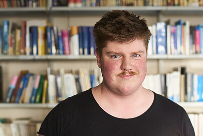
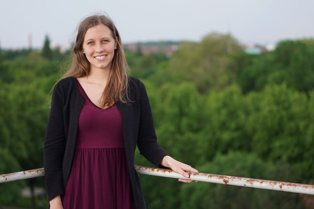
Tim Peter Jorg Schimansky, M.Sc.
from Germany
Employer: Leibniz University Hannover, Institute of Cartography and Geoinformatics
"Due to the small size of the study program, everyone knows everyone. This made it possible for me to get in contact with my professors without any big detours and to get the position as a research assistant I am currently working in."
-
read more about Tim's experience
I have always been interested in computer science, physics, math, and science in general. Geodesy combines these areas like no other discipline. I made the choice to study geodesy in Hannover because it is close to my home, so I knew that Hannover is a livable place despite the general perception.
Geodesy is so wide-ranging that after studying it, you can look back on a huge collection of different ways of solving a problem. In addition to the many possibilities in application, there is also the option to specialize strongly in the field without limiting yourself. The size of the group of people I was surrounded by was similarly important for me during my studies. Since the size of a semester in the bachelor's program is comparable to the size of a school class, there is an almost familiar relationship with the fellow students of the same semester and with those of the adjacent semesters.
Due to the small size of the study program, everyone knows everyone. This made it possible for me to get in contact with my professors without any big detours and to get the position as a research assistant I am currently working in.

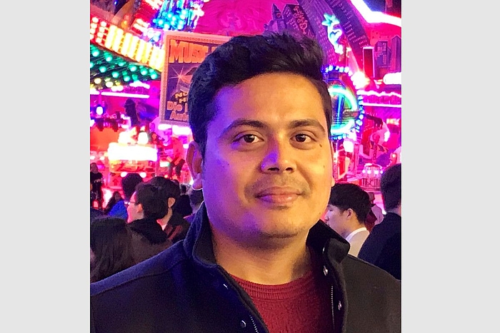
Mostafa Elesawy, M.Sc.
from Egypt
Employer: u-blox AG
"This master's program is designed to push students to their limits, encouraging them to acquire as much knowledge as possible. Through this journey, I gained a wealth of technical and soft skills, which have paved the way for my success as a collaborative team player."
-
read more about Mostafa's experience
A Master's in Geodesy and Geoinformatics is a comprehensive program that offers a wide range of learning opportunities. With various institutes within the program, you have the flexibility to choose subjects that align with your interests, thereby gaining a solid foundation in both Geodesy and Geoinformatics. This diverse knowledge base opens the door to exceptional job prospects. Furthermore, this master's program is exceptionally challenging, but upon completion, it rewards you with numerous job opportunities due to the substantial practical and theoretical expertise you acquire.
I work in the field of navigation, leveraging my bachelor's degree in Geophysics. The market has a significant demand for graduates with a background in navigation, especially given its potential to revolutionize autonomous driving in the near future.
This master's program not only helped me expand my knowledge but also facilitated numerous internship opportunities and part-time jobs in various companies. I ultimately chose to join a leading navigation company for my master's thesis, where I tackled real-world navigation challenges. This experience bridged the gap between theoretical and practical problems. Subsequently, I received a job offer from the same company, and I am now employed as a Functional Safe GNSS System Engineer.
In practical terms, this master's program is designed to push students to their limits, encouraging them to acquire as much knowledge as possible. Through this journey, I gained a wealth of technical and soft skills, which have paved the way for my success as a collaborative team player.
To prospective students considering this program, my advice is to carefully review the course curriculum and prepare for an engaging journey filled with both challenges and rewards. By the end of the master's program, you will emerge as a transformed individual with a promising career path ahead.
Graduates 2021


Md Abdullah Al Faisal, M.Sc.
from Bangladesh
Employer: u-blox AG
"Using excellent instructional materials and programming skills, I had the opportunity to become highly proficient both theoretically and practically, and it helped me get a job immediately. "
-
read more about Abdullah's experience
I began this Master's programme in Germany, as it is one of the leading countries for technical studies. All the professors and teaching staff that I had a chance to attend their lectures, are always willing to help, answer all the related questions, and provide a supportive environment for conducting successful studies. It was a completely profound experience that led me to my successful professional life.
All four institutes collaborating in this program offer a broad and balanced curriculum. I attended the courses offered by all four institutes, and developed a keen interest in remote sensing, image analysis, positioning and navigation, GNSS receiver technology, GIS and big data, etc. The prior knowledge I had in these fields was complemented well by what we were taught, and we learnt something new in each course.
Speaking of information and professional application, this Master's programme is quite competent. I started to work in the navigation field and am currently working as a GNSS Service Engineer, where I am using a lot of what was taught in the courses "positioning and navigation" and "GNSS receiver technology". Using excellent instructional materials and programming skills, I had the opportunity to become highly proficient both theoretically and practically, and it helped me get a job immediately.
I would recommend Geodesy and Geoinformatics to those who want to take on new challenges as it opens the door for an eager mind. So, meet new people, immerse yourself in a new environment, learn about a new culture, and, of course, benefit from the greatest teaching techniques available!
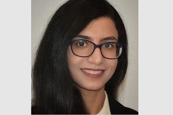

Razieh Hosseini, M.Sc.
from Iran
Employer: IAV Automotive Engineering Company
"I would recommend this program to those who wish to face excellent opportunities in the field of navigation and autonomous driving. Staff members and Professors have a close connection with students and are very open to new ideas and opinions from them. "
-
read more about Razieh's experience
I'm so delighted to spend my Master's at Leibniz University. I could not imagine how warm-hearted and sympathetic the people at this faculty are. Staff members and Professors have a close connection with students and are very open to new ideas and opinions from them. Students have to deal with new concepts and modules, which itself opens up new thoughts and questions. There is great support from Professors and assistants all along the way.
As a student with a computer science background who had to handle new subjects, I found Geodesy and Geoinformatics exhilarating. The program offers hands-on labs in different topics navigating students to a suitable level of practical skills. The student will gain self-confidence in programming and development. Moreover, since the methods taught in lectures and exercises are the latest, it helps students become well-prepared for the industry.
Until now, I got the opportunity to experience both public and private sector companies in Germany, making me realize how much this interdisciplinary program was helpful for me. Now I work as a member of the Data scientist group in R&D section of an automotive company, where we try to build navigation systems with sustainable development perspective as well as environment perception systems using cost-efficient and scalable vSLAM. I would recommend this program to those who wish to face excellent opportunities in the field of navigation and autonomous driving. I would say there are lots of future ways to follow either in career or research.
Olga Shkedova, M.Sc.
from Ukraine
Employer: Leibniz University Hannover, Institute of Cartography and Geoinformatics
"The big advantage is that, during the study, students have the possibility to participate and work on real projects. As a result, after graduation, many students are already experienced and have scientific publications that much benefit a specialist."
-
read more about Olga's experience
After graduation from "Geodesy & Geoinformatics" program at Leibniz University, I can declare that this program definitely deserves the attention of all students who are planning to get a Master's degree in Germany.
First of all, the program is well organized and oriented to provide a strong basis in all the fields of Geodesy and Geoinformatics. The teaching material is modernizing all the time, and you have an opportunity to learn up-to-date technologies and methodologies. The program provides exercises suitable for all levels of previous education and programming skills. The variation of interdisciplinary courses gives a chance to get wide knowledge and make certain of the most desirable future career direction individually.
The study in this program was a big challenge for me as long as I had a significant break between my Bachelor's and the Master's education. However, the attentive, responsive teaching staff and the comfortable university atmosphere made the hard challenge a very interesting and joyful scientific journey.
The big advantage is that, during the study, students have the possibility to participate and work on real projects. As a result, after graduation, many students are already experienced and have scientific publications that much benefit a specialist.
This program opened me to a new world of science and many job vacancies. Currently, I have started to work as a researcher at the Institute of Cartography and Geoinformatics at Leibniz University Hannover. I am very happy that I chose this program once!


Anne Ponick, M.Sc.
from Germany
Employer: Leibniz University Hannover, Institute of Photogrammetry and GeoInformation
"I studied both my Bachelor's and Master's degrees in "Geodesy and Geoinformatics" here at the Leibniz University in Hannover. The degree programme is rather small and with the other students you are like a small family and you make friends for life."
-
read more about Anne's experience
I studied both my Bachelor's and Master's degrees in "Geodesy and Geoinformatics" here at the Leibniz University in Hannover. The degree programme is rather small and with the other students you are like a small family and you make friends for life. Another advantage of the smaller size of the programme is that you also have good contact with the supervisors and professors. In addition, you often sit together in the "CAD pool" while studying and working on assignments. This makes studying and working on the exercises more fun. Nevertheless, it is very important that you also learn to work independently and solve problems on your own.
In the exercises, you learn to apply the theory from the lectures to smaller practical examples, which helps you to understand the lecture material. I also did an Erasmus semester in Budapest right at the beginning of my Master's programme and was able to get credit for courses. I can recommend such a step to anyone.
There is a wide range of courses to choose from. I myself took more courses in geoinformatics than in geodesy. But the compulsory courses train you in both areas and give you a very broad field of knowledge after graduation. After I finished my Master's degree, I started working at the Institute of Photogrammetry and GeoInformation (IPI).
Graduates 2020

Samaa Al-Khrisha, M.Sc.
from Jordania
Employer: u-blox AG
"If you are looking for enhancing your career path, I highly recommend the GuG master program for you!"
-
read more about Samaa's experience
If you are seeking an exciting educational adventure that gives you the opportunity to challenge yourself, meet new people and gain new knowledge every day, then Geodesy and Geoinformatics "GuG" master program at Leibniz University Hannover will definitely fit your aspirations.
During the time I spent at Leibniz University Hannover, I had the chance to meet new friends from different countries and backgrounds. I learnt new and interesting things about their cultures and traditions, and as a result of this built a strong social network that helped me afterwards in my career. The teaching staff have a wide experience in their respective fields, and they are always supporting and encouraging the students to become better. I can confidently say that everyone at GuG was a source of inspiration and motivation for me.
Hannover itself is a vibrant and full-of-energy city. You can easily enjoy your time here, it has lots of museums, theatres, historic sites, natural places such as rivers and green areas, and of course, many modern fairgrounds. I felt connected to this magical city ever since I arrived!
The master degree covers many topics, such as Navigation Systems, Image Analysis, Big Data Analysis, Land Management, Surveying, amongst other interesting topics. As there are different fields in the same program, it exposes the students to various different possibilities! The program is well structured, and thanks to the exciting and indulging exercises and projects in all courses you will enjoy every single moment in this journey.
I started working immediately after my graduation with a leading company in the field of developing chips and modules that supports Global Navigation Satellites Systems. If you are looking for enhancing your career path, I highly recommend the GuG master program for you!


Jeldrik Axmann, M.Sc.
from Germany
Employer: Leibniz University Hannover, Institute of Cartography and Geoinformatics
" At the beginning, I was slightly overwhelmed from the programming requirements, but with some effort my skills constantly increased and programming turned out to be fun and less complicated than expected in the first place."
-
read more about Jeldrik's experience
After finishing my Bachelor‘s degree in Automotive Engineering, I chose "Navigation and Field Robotics" (NuUR)* for my master studies since it teaches the fundamentals necessary for modern automated driving functions.
The content of this program is provided by four institutes with the focus on Filtering, Navigation, Photogrammetry and Laserscanning/SLAM. The institutes complement each other very well resulting in a perfectly matched study program. During the three semesters before the final master thesis, every lecture comes along with assignments to apply and deepen the newly learned knowledge. The lectures and assignments are challenging and promoting at the same time, however, in case of difficulties, the helpful, dedicated and excellent professors as well as research assistants do not hesitate to explain topics a second time.
Additionally, in every semester, students choose projects provided by the four institutes, which give the possibility to dive deeper into specific domains where one is interested in. Those projects are related to current research indicating the up-to-date content of the study program. Apart from subject-specific knowledge, one acquires expertise in state-of-the art applications like the Robot Operating System (ROS). At the beginning, I was slightly overwhelmed from the programming requirements, but with some effort my skills constantly increased and programming turned out to be fun and less complicated than expected in the first place. Therefore, I strongly recommend not to hesitate to choose this study program only because of missing programming skills. You will learn those skills on the fly along with the assignments. I rather recommend to take the chance of participating in such a relevant field of study to be prepared for future careers, either in industry or academia.
During my studies, my main interest was in laserscanning and research based on LiDAR data, to which my research project as well as my master thesis were related. As a consequence, I started my PhD at Institute of Cartography and Geoinformatics working on Maximum Consensus Localization based on LiDAR data.


Carolina Canizares, M.Sc.
from Ecuador
Employer: Planet Labs Inc.
"It turned out that I lived one of the greatest times of my life. There were many ups and downs, many challenges, but I am glad to say that I had the support of teachers and classmates anytime, and even more when I was feeling that I would not make it to the end. "
-
read more about Carolina's experience
I would like to tell you about my personal experience as part of the Geodesy and Geoinformatics Degree Programme. I did not know what to expect from the teachers, professor, classmates, and the people I was looking forward to meeting in my new experience, far away from home. It turned out that I lived one of the greatest times of my life. I was the only person coming from Latin America all over my studies, which does not mean that I was feeling alone, but totally the opposite. There were many ups and downs, many challenges, but I am glad to say that I had the support of teachers and classmates anytime, and even more when I was feeling that I would not make it to the end.
On the academic aspect of my experience, one of the things I remember and appreciate the most was the commitment that I received from the academic staff that is part of this program. The lecturers, as most of the students, were not native English speakers, but the quality of their lectures, and their evident knowledge, make this program stand out. During my studies, I was more related to the Geodesy side of the program, but it does not mean that the Geoinformatics side could not be followed, as in my case. I ended up doing my master thesis at the Institute of Photogrammetry and GeoInformation, and I truly enjoyed the experience I had working both with satellites and with satellite images.
I am currently working for Planet Labs, a company that builds satellites, but offers the images taken by them. I am working as a Satellite Tasking Engineer, and I can acknowledge that what I learned, both from the Geodesy and the Geoinformatics side of my studies is put into practice and perfectly show the match of the content given from the classrooms.
If you are thinking about joining this great experience, got for it! I am sure things will be excellent.
Rebekka Handirk, M.Sc.
from Germany
Employer: European Space Agency (ESA)
"This programme opened up many doors, and the combination of a good degree and a desperate need for geodesists in industry and administration puts me into a situation where I can basically choose my future job and employer instead of them choosing me from a long list of candidates."
-
read more about Rebekka's experience
Just as in the bachelor’s program, everyone is taught the basics of all the different fields of application of Geodesy and Geoinformatics, but besides that, this master’s program allows the students also to choose from a variety of courses and thus enables them to deepen their knowledge in their individual area of interest – be it classical surveying, big data, or navigation. The relatively small number of students ensures close contact with professors and staff, a big advantage in comparison to many other careers.
When I proceeded from the German bachelor’s to the international master’s program, it felt like my new fellow students brought the countries of the world home to me instead of me having to travel the world. This program is not just studying the aspects of Geodesy and Geoinformatics but automatically includes gaining and improving intercultural and also interdisciplinary competencies, since many internationals join this program with backgrounds such as civil engineering or computer science.
I am currently working as a Young Graduate Trainee at the European Space Agency, for test development in navigation. I am working on and with cutting-edge technology in precise point positioning, and each day holds new amazement and challenges for me. It is the perfect opportunity to apply what I learned in the master’s program and to further deepen my knowledge. Even though personal networking is quite difficult in times of COVID, my job includes cooperation with various research institutes, universities, and NASA, and I am learning a lot about project management along the way.
I would recommend this program to anyone who is willing to invest themselves because – let’s be honest – things will not always be easy. The bachelor’s and master’s program of Geodesy and Geoinformatics has provided me not only with technical knowledge but also with a lot of soft skills and resilience. It opened up many doors, and the combination of a good degree and a desperate need for geodesists in industry and administration puts me into a situation where I can basically choose my future job and employer instead of them choosing me from a long list of candidates.


Chaman Kirty, M.Sc.
from India
Employer: Enapter GmbH
"With a background of Mechanical Engineering, I was eager to learn more in the field of computer vision and autonomous driving and this course provided a perfect set-up to choose subjects to achieve it. It was truly an enriching experience and it made me ready to step into my professional life. "
-
read more about Chaman's experience
This study programme provides a great opportunity to challenge and learn with practical exercises. Professors and teaching staffs are really helpful and always provide an environment to research and explore deep in the research fields. It was truly an enriching experience and it made me ready to step into my professional life.
I started this programme in Winter Semester 2017/18 and came from the background of Mechanical Engineering. I was eager to learn more in the field of computer vision and autonomous driving and this course provided a perfect set-up to choose subjects to achieve it. With constant guidance and support of professors and teaching staffs, the whole course was really helpful to broaden my knowledge in several dimensions. The regular assignments and worksheets in different courses were challenging in start but it helped immensely to learn topics in depth.
Geodesy and Geoinformatics is a great course for eager minds. It will constantly challenge you and prepare you to do great things in a vast interdisciplinary field. I will strongly recommend this course and would suggest all the future students as an alumni that you can build a great career through this course, when you are ready to invest your time and efforts.


Swarnalatha Pasam, M.Sc.
from India
Employer: NET-TEC Ingenieurgesellschaft mbH
"My only advice to everyone who is interested in this course is, explore as many fields as you can within this course and try to learn new skills along the way. I would definitely recommend this course for students who accept challenges and motivated to learn more about Geodesy and Geoinformatics."
-
read more about Swarnalatha's experience
I feel really happy that I chose Geodesy and Geoinformatics for my Master Studies.
After my Bachelor studies in Civil Engineering, I had thought so much about which course to choose for my masters but when I came across this course at Leibniz University Hannover, I was very fascinated by the courses offered and immediately decided to do this masters program. GuG is a very interdisciplinary course where you study different courses, which lead to different fields. I personally feel that this masters program is more of a practical course, loaded with experiments, measurements and research rather than a theoretical one. The curriculum and lectures are up to date and includes all the recent developments in the field.
During my masters, I leaned more towards the courses that are offered by the Institute of Photogrammetry and Geoinformation and the Institute of Cartography to deepen my skills in Image processing, GIS, and Remote sensing. The institutes in GuG also offer a wide range of student assistant jobs, which on one hand supports you financially and on another hand provides you with the opportunity to apply your theoretical knowledge on real world projects. It is because of one of these work student jobs, I was fortunate to have found a full time job later on in GIS field.
I am currently working as a Project Engineer in telecommunications network field where I design fibre optic network plans with design protocols and responsible for managing GIS/Spatial database. My only advice to everyone who is interested in this course is, explore as many fields as you can within this course and try to learn new skills along the way.
I would definitely recommend this course for students who accept challenges and motivated to learn more about Geodesy and Geoinformatics.

Yunshuang Yuan, M.Sc.
from China
Employer: Leibniz University Hannover, Institute of Cartography and Geoinformatics
"If you are interested in robotics, autonomous driving, and programming with a solid theoretic knowledge base, I strongly recommend the NuUR specialization of the GuG program."
-
read more about Yunshuang's experience
If you are interested in robotics, autonomous driving, and programming with a solid theoretic knowledge base, I strongly recommend the NuUR specialization of the GuG program.
While studying another course I came across the flyer of NuUR and was immediately intrigued by the robots in the picture, and decided to study to NuUR. Without any background in geodesy, it was hard to understand the courses in the beginning. However, as my first semester went on, I was surprised to learn that the practical experiments and exercises were helping me understanding the theory that I did not have sufficient background knowledge about.
We were regularly given home assignments in most courses of this major. Even though it sometimes took me long to accomplish all the assignments, I felt it was worth it. In the assignments, I could get an exact feel of real data, real robots, and real sensors. This way I could develop a deep understanding of different algorithms with their real world examples and problems. I was given a chance to use the best way - learn by using and doing - to learn different programming languages and useful programming libraries.
Since this is an interdisciplinary major, everyone with related background is welcomed to apply and has the chance to meet people from different background. I am sure you would have a fantastic journey in NuUR!
Graduates 2019


Jens Golze, M.Sc.
from Germany
Employer: Leibniz University Hannover, Institute of Cartography and Geoinformatics
"The study of the Master programme "Geodesy and Geoinformatics" means to meet a lot of interesting people from all over the world. As a German student who is not from Hannover, it is a wonderful experience to come to a new place, and explore it together with the new colleagues."
-
read more about Jens's experience
The study of the Master program "Geodesy and Geoinformatics" means to meet a lot of interesting people from all over the world. As a German student who is not from Hannover, it is a wonderful experience to come to a new place, and explore it together with the new colleagues. The four different institutes provide a large variety of geoscience topics in which you can specialize in lectures, exercises, and seminars.
During my studies, I concentrated mostly on the Geoinformatics aspects of the program which focus on the analysis of crowd-sourced trajectory data, web implementations and the analysis of sensor platform data such as Lidar measurements derived from a mobile mapping system (MMS). After the first semesters I worked as a HiWi student at the Institute of Photogrammetry and GeoInformation (IPI). During this work, I got involved in the practice of holding practical exercises and correcting assignment.
After my graduation I started working at the Institute of Cartography and Geoinformatics at the Leibniz University Hannover, in the field of movement data analysis and teaching.
Rozhin Moftizadeh, M.Sc.
from Iran
Employer: Leibniz University Hannover, Geodetic Institute
"I expected to face many difficulties in Germany. However, despite my presumptions, I was welcomed by a city with a spectacular nature, warm-hearted people and a university community which was motivating, helpful, and provided all means that one needs for studying and engaging in a scientific field."
-
read more about Rozhin's experience
Coming from a totally different culture and an educational system which practiced on a whole different level, I expected to face many difficulties in Germany when I moved here to start my master studies in Geodesy and Geoinformatics at the Leibniz University Hanover. However, despite my presumptions, I was welcomed by a city with a spectacular nature, warm-hearted people and a university community which was motivating, helpful, and provided all means that one needs for studying and engaging in a scientific field.
Geodesy and Geoinformatics is an interdisciplinary field of study, which has a broad aspect, giving a great opportunity to those who are interested not only in engineering, but also computer science and programming. In this field of study at this university, I had the opportunity to not only learn the theoretical content, but also their practical aspects by means of helpful exercises that were to be accomplished in different courses. Most of the exams were held in oral form, which greatly helped to always see the big picture and to not get lost in details that were already covered in the exercises.
As a graduate of this field of study and now doing my doctorates in the same field at the same university, I can strongly recommend it to all those who are interested to dive more into detail in Geodesy and Geoinformatics.
Hasan Sharifi, M.Sc.
from Afghanistan
Employer: Zweckverband Gigabit
"For those interested in getting into the job market, the geodetic excursion and the courses would be interesting, in which the employees active in the industry present their practice-based work. One can find and establish a stable future employment network in any desired direction."
-
read more about Hasan's experience
The master program Geodesy and Geoinformatics offers a variety of courses focused on many different geodetic topics. Along the fundamental courses, the students have the chance to carry out a project seminar and a master thesis in their desired field. The students deal with the newest research topics and get a know-how of approaching and solving complex scientific issues. For those interested in getting into the job market, the geodetic excursion and the courses would be interesting, in which the employees active in the industry present their practice-based work. Overall seen, one can find and establish a stable future employment network in any desired direction.
During the masters, I got the chance to carry out an internship and master thesis at the German Research Center for Geosciences (GFZ) – Potsdam which involved me in a scientific environment with thousands of researchers working on geosciences. During my time at GFZ, I got experience in the remote sensing field and analyzing the satellite imagery data, by participating in scientific presentations, meetings and conferences.
I am currently working as technical leader in Zweckverband Gigabit Landkreis Göppingen, and I work with a large range of telecommunication network data as a GIS specialist. The goal of our public private partnership (PPP) infrastructure project is to develop the extensive broadband and optical fiber technology for the region of Stuttgart and the Göppingen district until 2030. The knowledge I gained from the master studies in Hannover has enabled me in interpreting and analyzing the geospatial data, which are consequently used for the planning purposes. Within my range of responsibilities, I participate in the meetings and discuss the issues with the experts within and outside the project.
I would recommend this master program to the prospective students who have the passion of learning various geodetic topics. Besides, Hannover offers a convenient environment for the students, including affordable rent, well-integrated public transportation, and many international students.


Vishwa Vijay Singh, M.Sc.
from India
Employer: Leibniz University Hannover, Institute of Geodesy
"With the amazing study programme which gave me the choice to study exactly what I want, wonderful student coordinators who were always up for a chat to discuss the path chosen, and truly knowledgeable lecturers whose enthusiasm made me 500% more interested in any course, I think the GuG master programme stands out."
-
read more about Vishwa Vijay's experience
I joined the M.Sc. Geodesy and Geoinformatics (GuG) in 2016, was lucky enough to spend six wonderful semesters in the master program - taking the master a bit slow (six semesters instead of four), while also working and learning German. With the amazing study program which gave me the choice to study exactly what I want and at the pace that I want, wonderful student coordinators who were always up for a chat to discuss the path chosen within the M.Sc., and truly knowledgeable lecturers whose enthusiasm made me 500% more interested in any course I decided to attend, I think the GuG master program stands out.
LUH and GuG are great places to be at, whether one wants to continue in research, or get a job later. People who are interested in this filed can do wonders, for example, help Google or Apple make their maps better (web-GIS) and more accurate (GPS modeling), help automobile manufacturers make better and safer automatic cars (Image processing), help aerospace companies make sure that all the parts of their planes are safe to be used (Industrial Surveying), or help the space agencies of the world figure out how round the Moon is (Physical and Astronomical Geodesy). With the right ideas and inclination, one can shape their future as they want, once they are here!
After the M.Sc., I decided to continue down the path of research, and am currently doing a PhD at the Institute of Geodesy in “Lunar Laser Ranging” (LLR). Having had an opportunity to explore the science of LLR in a project during the M.Sc., I knew I could not part from LLR just then, and decided to work on an aspect of LLR - calculating the position and velocity of the solar system bodies - for my master thesis. Half way through the thesis, I knew LLR was what I wanted to continue my career in. Thankfully, there are plenty of opportunities to find a PhD after the M.Sc., and I was lucky enough to find one in Hannover itself.
Other than the master program, I have been thoroughly enjoying my time here in Hannover. The city is full of excellent cafes, has many areas and restaurants to explore, and still very student friendly. It is, and would be a great place to study GuG!


Zhiyuan Wang, M.Sc.
from China
Employer: German Aerospace Center (DLR)
"It was my pleasure to enroll in the Master program "Geodesy and Geoinformatics" at Leibniz University Hannover. I sincerely appreciate the knowledge I gained and would love to recommend this Master's programme to those who would like to dive into Geoscience in the future."
-
read more about Zhiyuan's experience
It was my pleasure to enroll in the Master program "Geodesy and Geoinformatics" at Leibniz University Hannover. Created and provided by 4 institutes, this Master program offers the student all possible directions of Geoscience. Students can decide which direction they would like to go without putting too much effort into their weak subjects. Aside from a variety of lectures, students can also practice what they learned through different seminars.
Besides variety of lectures, our Institutes also encourage and support students to do practical work and provide students opportunities to work with professional research groups. During my study, I put my concentration on remote sensing and image analysis. Started from 2017, I worked as a student research assistant at Institute of Photogrammetry and GeoInformation (IPI). This precious experience deepened my understanding in remote sensing and strengthened my data processing and programming skills. Additionally, it provided me the first-hand experience of doing scientific research.
Now I work as a scientist at the German Remote Sensing Data Center, EOC of German Aerospace Center, DLR, where I contribute my knowledge in the field of Earth modeling based on satellite remote sensing data. I sincerely appreciate the knowledge I gained from "GuG" and would love to recommend this Master program to those who would like to dive into Geoscience in the future.


